Florida's East Coast Faces Multi-Day Flood and Rip Current Threat
A multi-day flood event is inundating Florida's east coast, with record river levels and life-threatening rip currents.
The St. Johns River near Cocoa was already in major flood at 17.13 feet on Tuesday, November 17, 2026. A slow-moving low pressure system is now delivering 4 to 8 inches of rain over multiple days, causing record river levels and widespread flooding across east-central Florida. Grounds across most of the region are already saturated from heavy rain two weeks ago. The Weather Prediction Center has placed portions of the East Central Florida coast under a Moderate Risk, Level 3 out of 4, for excessive rainfall through Friday.
Forecast rainfall totals range from 4 to 6 inches across east-central Florida. Localized totals could reach 8 to 12 inches near the Atlantic coast. Isolated totals exceeding 12 inches are possible in Brevard and Volusia counties. On Thursday morning, the St. Johns River near Cocoa climbed past a flood record that had stood since 1953. A National Weather Service flood statement issued at 6:11 a.m. EST Thursday put the river at 18.0 feet at 5:15 a.m. This is well above its 16-foot flood stage and its previous record of 17.55 feet from October 1953. The river is forecast to rise to 17.2 feet by 07:00 EST on Thursday, November 19.
Life-threatening coastal hazards
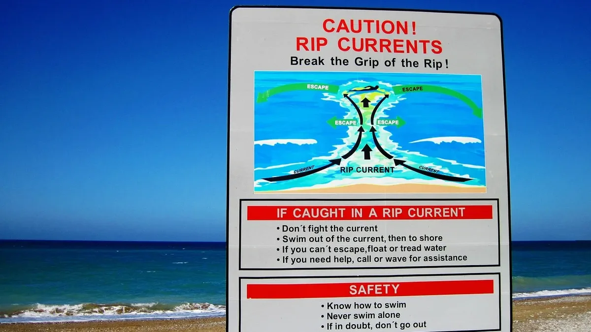
Dangerous rip currents and high surf threaten beaches from Duval County to Miami-Dade through Friday evening. A High Rip Current Risk covers the east-central coast and the Miami-Dade, Broward and Palm Beach beaches. Forecasters said the rip currents are life-threatening. The NWS Melbourne has a High Surf Advisory through 7 p.m. EST Friday. Breaking waves of 5 to 10 feet are possible, with moderate to locally major beach erosion. Persistent onshore winds may push ocean water toward the shore and cause minor tidal flooding near high tide.
The National Hurricane Center is watching an area where low pressure is expected to form near the northwest Bahamas by late Friday. As of its Thursday morning outlook, the NHC gave it a 20% chance of development within 48 hours and a 60% chance within seven days. The track is highly uncertain. NWS Melbourne said a closer path would raise rain and wind threats while a more offshore path could bring drier air.
Unusual flooding patterns and emergency responses
Multiple counties have declared states of emergency as flash flood warnings and school closures affect Brevard, Volusia, Indian River, Miami-Dade and Broward counties. Broward County, Fort Lauderdale and Hollywood declared states of emergency Wednesday. Governor Ron DeSantis expanded an earlier November emergency order to cover Broward and other Atlantic coast counties.
Schools were closed Thursday in Brevard, Volusia, Indian River and Miami-Dade counties. Broward schools were closed Wednesday and Thursday. Volusia schools will also stay closed Friday. The St. Johns River is one of the slowest-draining rivers in the country. That is why the earlier flood has never really ended for neighborhoods around Lake Poinsett, Rockledge and Cocoa. This is the same basin that took the brunt of the November 1 to 2 deluge. Up to 24.10 inches fell near Malabar then, and NWS Melbourne called it a one-in-1,000-year event. Two people died in Palm Bay during that flood.
Residents should monitor NWS flood statements and follow evacuation instructions from local officials as river levels remain above record stages through the weekend.